Software For Mapping & GIS

Broad range of field and office software solutions designed for Mapping & GIS applications.

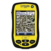
Trimble GIS software products are ideal for fast and efficient field GIS data collection and maintenance. Whether you need to populate a GIS for the first time, update your existing GIS database, or simply view and query GIS data in the field, Trimble’s software tools ensure you maximize productivity and data quality.

Trimble/Applanix leading mapping software tools enable GNSS/inertial post processing for georeferencing data collected from the field as well as data collected from cameras, LIDARs, multi-beam sonars and other sensors on mobile platforms.

Current Products include the POSPac MMS, TerraSync, TerraFlex, Pathfinder and Trimble Positions software.


Datasheet for Trimble GIS  Software Product Comparison


Quotation Request

Trimble Post-Processed software

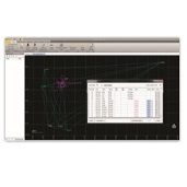
POSPac MMS™ (Mobile Mapping Suite) 8 is Applanix’ next generation of industry leading GNSS-Aided Inertial post-processing software for georeferencing data collected from cameras, LIDARs, multi-beam sonars and other sensors on mobile platforms.

Using Trimble® RTX™ technology, POSPac MMS 8 delivers significant new benefits for mobile mapping from land, air, marine and UAV platforms.

Key Features:

  • Post-Processed Trimble CenterPoint RTX trajectory processing  (PP-RTX)
  • Automatic base station survey using static PP-RTX
  • New floating license support – share a single license across a network or between computers
  • New User Interface
  • 64-bit processing for faster throughput
  • Windows 10 support
  • RTCM 3.2 support
  • Reduced acquisition costs
  • Reduced re-work costs with “know before you go” in field quality control
  • Faster production
  • Better accuracy
  • Increased utilization